Our assets in
São Tomé and Príncipe
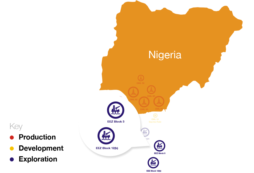
Exclusive Economic Zone (EEZ)
OER holds its interest in Blocks 5 and 12 in the Exclusive Economic Zone of São Tomé and Príncipe (“EEZ”) through its 81.5% interest in Equator Exploration Limited (“EEL”).
In February 2010, Equator was awarded the right to obtain Production Sharing Contracts (“PSCs”) on both Blocks 5 and 12 in accordance with agreements signed in 2001 and 2003. Block 5 has an area of 2,844sq km and is located east of the island of Príncipe, adjacent to Equatorial Guinea with water depths ranging from 2000m to 2500m whilst Block 12 is the most south-easterly block in the EEZ with an area of 7940 sq km in water depths ranging from 2500 to 3000m. Block 12 is the closest EEZ block to the North Gabon salt basin, lying some 150 km to the west of Port Gentil.
In December 2015, EEL entered into Farm Out agreements with Kosmos Energy. The transaction consisted of a transfer of 65% of its participating interests in each of Blocks 5 and 12 in return for $7.4 million to equalize past costs, with a 50% carry up to $9.0 million on each of the commitment wells for both Phases II and III of the Exploration period for Block 5 plus a carry of the first $2.0 million of OER’s portion of project costs for Block 12. Equator retains participating interests of 20% and 22.5% in Blocks 5 and 12 respectively.
EEZ Blocks 5 & 12*
| Working Interest % | Block 5 | Block 12 |
| Equator Exploration | 20.0% | 22.5% |
| Agência Nacional do Petróleo (“ANP-STP | 15% | 12.5% |
| Kosmos Energy | 45% | 45% |
| Galp Energia | 20% | 20% |
In February 2016, EEL secured governmental consent on Block 5 and concluded on the PSC negotiations on Block 12. The closure documents for Block 5 were executed at a signing ceremony with the ANP-STP on the 19th February 2016. Governmental consent for Block 12 was secured in March 2016 and subsequently the transaction documents were executed on the 31st of March 2016. Operatorship status was relinquished and transferred to Kosmos Energy on both Blocks.
Post the farmout transaction, Kosmos has also farmed out part of its participating interest and has proceeded to validate our technical work and proposed the acquisition of 3D Seismic data to cover four blocks withinthe EEZ including blocks 5 and 12 to gain a full regional understanding of the underlying geology. The seismic acquisition campaign commenced in January 2017.
The maritime boundaries of São Tomé & Príncipe encompass an area of approximately 160,000 square kilometers. The close proximity of São Tomé & Príncipe’s offshore waters to the proven hydrocarbon systems in the adjacent waters of Nigeria, Cameroon, Equatorial Guinea and Gabon suggests the potential for hydrocarbons, which is further supported by regional seismic data and petroleum seeps seen on the islands.
Background:
The Production Sharing Contract (‘PSC’) for Block 5 was executed with the National Petroleum Agency of São Tomé & Príncipe on the 18 April 2012. With the exception of the level of carried participation for the government, the terms of the PSC for Block 12 have been agreed.
Both assets are offshore deep-water, depth ranging between 2,000m and 3000m with acreage sizes 2,844 and 7,939 km² for Block 5 and 12 respectively.
Block 5 has an area of 2,844 sq km (three times the size of Nigerian 2005 deepwater blocks) and is located east of the island of Príncipe, adjacent to the Equatorial Guinean shelf with water depths ranging from 2000 to 2500m. The block is within Zone A of the ANP block classification scheme. There are no wells in the EEZ. Within Block 5, there are approximately 1500 km of 2D Seismic data on a wide spacing of about 2.5km by 5km. Seven main seismic horizons at Basement, Albian, Campanian, Top Cretaceous, Mid Eocene, Neogene and Seabed were mapped in time and depth across the block. Numerous prospects are identified, predominantly associated with structural trapping geometries over the Kribi fracture zone.
Closures in the Mesozioc section from the Albian through to the Upper Cretaceous are considered prospective. Further opportunities exist within stratigraphic plays in the Upper Cretaceous and potentially the Tertiary.
Block 12 has an area of 7939sq km and is located in the south east side of the island of Sao Tome, adjacent to the Gabon shelf with water depth ranging from 2000 to 3000m. The block is within the Zone B of the ANP block classification scheme. There are no wells within the EEZ. Within block 12, there are approximately 988km of good quality 2D line data on a wide spacing of 2.5km by 5km. The PSC for Block 12 is still under negotiation.
Recent Developments:
The Company continued to seek farmout partners in order to manage the exposure to the risks of high cost exploration in a frontier province in ultra-deep water. A number of companies visited the data room in order to assess the opportunity and some have expressed interest.
Following the signing of the Production Sharing Contract (‘PSC’) for Block 5 with the National Petroleum Agency of São Tomé & Príncipe on the 18 April 2012, a signature bonus of US$ 2million was paid. A performance bond of $5.2 m was submitted to the National Petroleum Agency in February 2014 in line with the minimum work commitment for phase 1 work program.
The 2014 activities were geared towards delineating the information available in order to ascertain the optimal location to acquire 3D seismic data. Over 1,700 km of existing 2D seismic data was reprocessed & reinterpreted together with the magnetic & gravity data available on the license area. The EIA for seismic activities was also delivered in 2014.
In 2015, approval to acquire 3D seismic over the license area was given by the ANP-STP. Equator acquired 1,400 sq. km of 3D seismic data through an ingenious risk sharing agreement with Geoex & BGP. All Data acquired are currently being delivered to the processing center.